Cutting-edge Imaging Technologies Enable a New View of an Ancient City
November 12, 2019
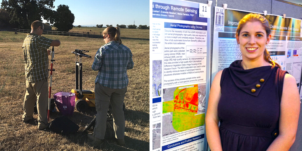
A doctoral student in Art, Art History & Visual Studies, Katherine McCusker is the geographic information systems (GIS) manager for the Smart Archaeology project team, which has been using smart technologies, such as robots, rovers, drones and laser scanners, to investigate ancient Mediterranean cities since 2014. McCusker received a Bass Connections Student Research Award to expand on her team’s work by completing a layered analysis of aerial and underground images collected through drone and ground penetrating radar surveys over the last four years. Ultimately, this analysis will be displayed in a series of maps that could reveal new discoveries such as how the ancient city of Vulci managed clean water, sewerage and drainage systems.
Aerial Image Processing: A New View of Vulci through NDVI
By Katherine McCusker
One of the benefits of living in this digital age is the increased access to cutting-edge technology and the large amounts of data these technologies are able to efficiently collect. One of the drawbacks of living in this digital age is the sheer amount of data collected that is then never fully analyzed.
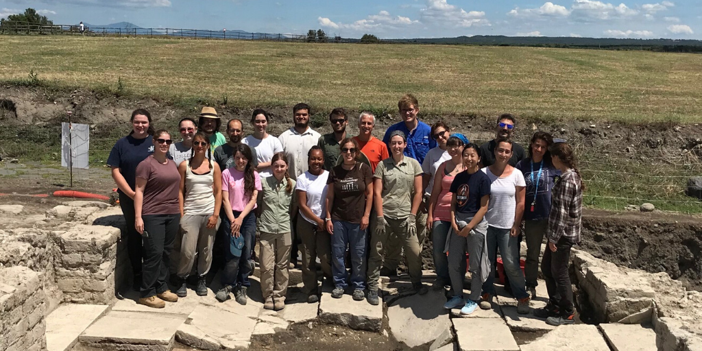
My research over this past summer expanded on a collection of over 2,500 images from a multispectral aerial survey completed by the Smart Archaeology project team in the summer of 2016 in Viterbo, Italy. Our team is comprised of five research units, who collaborate on archaeological investigation and the study of important ancient cities of the Mediterranean using new methods and technology to collect data on a micro- and macro-scale. Working with the Duke Marine Lab’s Robotics and Remote Sensing Lab, we used an eBee sensefly drone to gather normal color (RGB), red edge and near-infrared images of the entire plateau and surrounding landscape that encompasses the ancient Etruscan-Roman city of Vulci. This fieldwork yielded high-quality, very detailed mosaic images of the site, which we could use in our research, visualizations and analyses.

My summer research project focused on further utilizing this collection of aerial images in order to provide additional insight into the layout of the urban center and the landscape of the city. Continued support from Bass Connections allowed me to purchase the specialized software Pix4D and work in the dig@lab in Smith Warehouse to process these images in additional ways.
After initial processing of the red edge images, I was able to use index analysis tools to create an index reflex map, which was the base for visualizing a Normalized Difference Vegetation Index (NDVI) image. NDVI measures the health of the vegetation in an area. Extremely healthy vegetation will be coded green while very unhealthy vegetation will be coded red, with a sliding scale of yellow to orange in-between. This indicator is used both in agriculture and archaeology. For example, especially unhealthy vegetation indicates that something underneath the ground is preventing that area from getting the nutrients it needs. This result indicates the presence of dense material, such as foundations of a buildings, roads or other features.
Initial analyses from these images confirm the location and arrangement of the street grid of the ancient city. The layout of the city is an important indicator of social organization and division of space. These NDVI images will be added to my layered, geospatial analysis for my dissertation, which focuses on understanding the transition period of the urban morphology of Vulci from Etruscan rule to Roman rule and the city’s shifting identity. My research depends on data from new, noninvasive technologies to create a new approach to studying buried ancient cities that previously was not possible. My work from this summer will both support the continued, collaborative work of the Smart Archaeology team as well as my own research.
Special Event on November 20
Join us on Wednesday, November 20, at noon for Smart Archaeology: Uncovering Secrets beneath the Surface.
Presenters include team leaders Maurizio Forte, David Zielinski and Todd Berreth; doctoral students Tyler Johnson, Katherine McCusker and Antonio LoPiano; and undergraduates Achilles Dabrowski, Anna Gotskind, Himanshu Jain, Aaron Paskin, Alex Xu, Gary Zheng and Olivia Zitkus.
This presentation is sponsored by the John Hope Franklin Center and the Duke University Center for International and Global Studies. A light lunch will be served. Parking is available in nearby Trent Rd. and Erwin Rd. parking decks. The series provides one-hour parking vouchers to guests.
Learn More
- Explore the 2018-2019 Smart Archaeology project team, and learn what the team is doing this year.
- Meet all of the 2019 Student Research Award grantees.
- Read the Bass Connections 2018-2019 Annual Report, and browse student stories.