Energy Infrastructure Mapping Using AI
Project Team
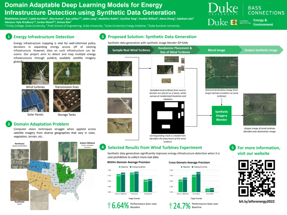
Energy infrastructure mapping is vital for well-informed policy decisions around energy access expansion, but data on existing infrastructure can be scarce. Previous work has shown that these information gaps can be filled by applying machine learning techniques to satellite and aerial imagery. However, computer vision techniques struggle when applied across satellite imagery from diverse geographies. More scalable and versatile techniques are needed to assess infrastructure relevant for sustainable energy transitions.
This team set out to develop a better way to detect and map multiple energy infrastructures through publicly available satellite imagery globally by applying synthetic data generation techniques, including generative models and style transfer, for creating synthetic overhead imagery; comparing these techniques with traditional, high-effort techniques for training data collection and recent 3D modeling approaches; and sharing these tools and generated data in an open-source repository to encourage use by other researchers and decision makers.
Ultimately, the team found that their proposed solution using synthetic data generation significantly improves energy infrastructure detection when collection of real data is cost-prohibitive. They hope that their technique will aid efforts to expand sustainable energy.
Learn more about this team’s work by exploring their website.
Domain Adaptable Deep Learning Models for Energy Infrastructure Detection using Synthetic Data Generation
Poster by Madeleine Jones, Caleb Kornfein, Alex Kumar, Aya Lahlou, Jaden Long, Madeline Rubin, Caroline Tang, Frankie Willard, Alena Zhang, Saksham Jain, Kyle Bradbury, Jordan Malof and Simiao Ren