How Drones Can Help Researchers Investigate and Protect Coastal Ecosystems
June 20, 2019
Kelly Dobroski reflects on her experience developing drone-based remote sensing techniques to evaluate fragile coastal ecosystems.
By Kelly Dobroski ’19 (Master of Environmental Management)

My Bass Connections project completely shaped the second year of my master’s degree.
In 2018-19, I served as the project manager for a team using drones to develop rapid, cost-effective methods to evaluate coastal biodiversity and resilience. This team of three brilliant women (two undergraduates and one graduate student) led by an incredibly supportive postdoc, taught me invaluable lessons – from how to streamline data processing to how to be a better leader.

Our project sought to determine whether or not drones could be used to monitor coastal environments accurately and efficiently. We chose to start with salt marshes, as these provide coastal defense from storms and habitat for a range of plant and animal life as well as helping to improve water quality. However, these habitats have been in decline over the last century, which is motivation to monitor them more closely.
Current monitoring practices require teams to spend hours in the field, walking through the marsh to collect data. Not only is this time consuming, it can also cause damage to the marsh. Implementing drones can reduce the physical impact to the marsh and increase the number of sites that can be monitored in the same amount of time.

Based at the Duke Marine Lab (Beaufort, NC), we were able to select local field sites. We spent most of the summer of 2018 in the field counting marsh grass stems and determining grass height, both indicators of marsh health. These were some of my favorite memories of our time as a team – completely covered in mud, getting poked in the eye by tall grasses – because this was how our team first bonded. We immediately needed to trust each other to accurately collect and record data, and I was proud that team members so quickly relied on each other to collect this information.
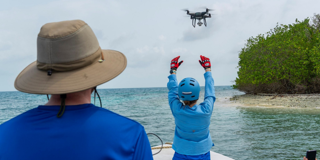
Our team also planned to survey mangroves in Belize. From initial planning in the summer of 2018, this piece of the project grew from plans to survey in one location to the goal of surveying three different regions of Belize. In May 2019, we collaborated with three local nonprofits and the World Wildlife Fund to conduct surveys of mangroves. We explored mangroves cayes (small islands) in Punta Gorda, the impacts of tourism on mangroves in Placencia and towering mangroves in regions of Sarteneja, and each of these regions provided unbelievable views and incredible support from each of the organizations we worked with. This was my first time collaborating internationally, and the experience I gained submitting permit requests and assisting with survey location selection was an invaluable addition to my formal education and classroom experiences.

I’ve been fortunate enough to have access to so many opportunities while at Duke, and managing this project has been one of my proudest achievements during my master’s degree. From learning how to better communicate with and support team members to learning how to manage data and multiple timelines, my experiences with this project will forever be some of my fondest memories.
Learn More
- Check out the Developing Rapid, Cost-effective Methods for Evaluating Coastal Biodiversity and Resilience project, and learn what this the team will be doing in 2019-2020.
- Explore Bass Connections in Energy & Environment.
- Browse Bass Connections summer programs, and save the dates for the Story+ Research Symposium, the Summer Neuroscience Program Poster Session and the Data+ Poster Session.